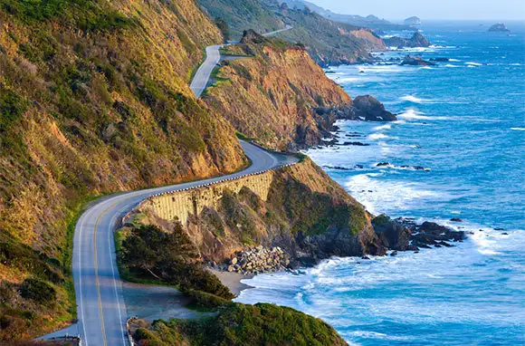
Summertime means road-trip time. One-of-a-kind drives, offering jaw-dropping views out the windshield, show off distinctive regions of the United States at their best. Some routes are short (you can do them in a day), while the more grand ones require a long weekend or more.
Pile the family into the car and pack a picnic lunch to enjoy at an unhurried pace. You’ll want to make time to breathe in the fresh air and create your own memories. Stay on the lookout for wild animals and blooming flowers along these roads—they’re part of the scenery. Read on for 10 of our favorite iconic drives.
Image Gallery
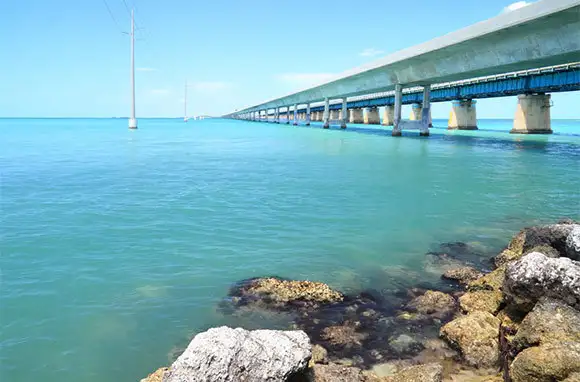
Overseas Highway, Florida
Distance: 150 miles from Miami to Key West
This road begs for a convertible. From Miami, drop down on U.S. 1 through Homestead, then cross the spongy ground of the Everglades before popping out onto Florida Bay at Key Largo. Along the way, you'll cross 42 overseas bridges, including the famous Seven-Mile Bridge. As you head south, go in search of the best key-lime pie or count the herons and egrets wading in crystal-clear waters.
If you don't have time to charter a fishing boat, stop off at Robbie's of Islamorada to feed the six-foot-long tarpon that hang around the dock. In Marathon, visit the Turtle Hospital to meet recovering wild sea turtles and the people who've devoted their lives to saving them. Afterwards, sample the seafood and key-lime pie at the Keys Fisheries Restaurant.
Further south, reapply your sunscreen on the beach at Bahia Honda State Park, and then search out the bat tower on Sugar Loaf Key before heading into Key West and the mile-zero marker. Celebrate being at the southernmost point in the continental U.S. with a pub crawl along Duval Street.
Pacific Coast And Cabrillo Highways, California
Distance: 186 miles from Morro Bay to Big Basin
If you like the feeling that you might drop off the right side of the road into the Pacific Ocean, drive north to south. Otherwise, the most scenic views are offered when you head north. The entire Pacific Coast Highway actually stretches 2,500 miles, from the southern point of Baja California to the tip of the Olympic Peninsula, but its most famous stretch, known as the Cabrillo Highway, lies between Los Angeles and San Francisco.
Start at Morro Bay, a seaside village with a big volcanic rock where falcons whirl in sea breezes. Head north to San Simeon and plan to visit William Randolph Hearst's castle before exploring the wilds of Julia Pfeiffer Burns State Park in Big Sur. Fields of wildflowers, where you can picnic along the shore, stretch out to the coast. Beware of changing tides, as it's easy to become stranded on a waterfall beach when the surf quickly moves in. Inland, towering redwoods and ferns create magical forests for hiking.
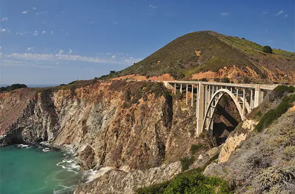
Park at Bixby Bridge to take your postcard shot of the famous span before moving on to Point Lobos State Natural Reserve, where sea otters and sea lions hang out above underwater kelp forests. Don't skip two more must-see sites, the Monterey Bay Aquarium and Big Basin Redwoods State Park, the oldest state park in California and home to the largest stand of ancient coastal redwoods south of San Francisco.
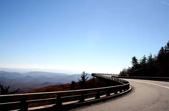
Blue Ridge Parkway, North Carolina and Virginia
Distance: 469 miles from the Great Smoky Mountains National Park to Shenandoah National Park
You can cherry-pick spots along this snake-like road that follows the backbone of the Appalachian Mountains, but if you want to drive the entire route, plan on three days at a pokey 45 mph. It won't feel that slow as you wind around S-curves and up and around mountains.
The Virginia portion is the less crowded part of the route, with rounder hills, hidden coves, and quirky stops like the Poor Farmer's Market (mile 177) and the Mayberry Trading Post (mile 180). Both are old-timey stores that feature apple butter, quilts, and fried pies for sale. The pace picks up near the Virginia-North Carolina state line at the Blue Ridge Music Center (mile 213)—try to be there at noon for a picking-and-grinning bluegrass jam on the deck.
In North Carolina, spend an afternoon picking heirloom apples along the Parkway at the Orchard at Altapass (mile 328). If you can do only one portion of the Parkway, make like a billy goat and climb up the five-mile spur road to Mount Mitchell (mile 355), the highest point east of the Mississippi River. At its elevation of 6,684 feet, July temperatures can drop by 20 degrees.
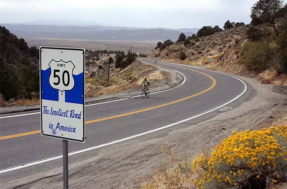
Highway 50, Nevada
Distance: 320 miles from Carson City to Ely
Like a marketing slogan, Life magazine proclaimed Highway 50 "the loneliest road in America" in 1986, and the name stuck. You'll see it plastered on signs along this desolate stretch that crosses Nevada. This is the land of big country, big sky, and endless highway.
The 70-mph speed limit makes the miles roll by effortlessly, but be prepared. Make sure your vehicle is in good repair and full of gas and that you have fluids and food before setting out across the vast emptiness, as there are few stops (they typically occur about every 100 miles).
The desert scenery is stunning, as clouds paint shadows across the ocher and maroon landscape. After zooming down a roller-coaster 7,500-foot pass into a shimmering desert, you half expect to see the Road Runner and Wile E. Coyote explode across the highway. Instead, wild elk, antelope, and cattle are more likely in this open range.
Highway 50 is in the land of mirages. You can see the old Pony Express Route running alongside the paved road between the historic mining towns of Eureka and Austin, and, after a while out there all alone, you may even hear the whisperings of ghost towns.
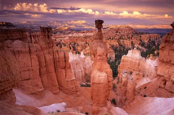
Southern Utah Parks, Utah
Distance: 231 miles from La Verkin to Capitol Reef National Park
You don't have to be a hard-core outdoors enthusiast to appreciate rugged Utah—although, for hikers and mountain bikers, this place is heaven. If you have a camera—or simply a photographic memory—you'll be just as happy.
Start just off I-15 near La Verkin and pick up Utah State Route 9 to transverse the otherworldly Zion National Park. The sandstone cliffs and multi-colored rocks can be deceiving from inside an air-conditioned vehicle, but it's mighty hot out there right now. Plan to get out and explore at the beginning or the end of the day, when the heat is less intense and the light slants pleasingly into your camera lens.
Follow U.S. 89 north to Utah State Route 12 to access Bryce Canyon National Park, land of the hoodoos, pillars of red rock. Part of the Grand Staircase-Escalante National Monument's geology, the canyons invite visitors on foot, too. But with more than 1,000 miles of roads crisscrossing the region, you won't tire of the view from the car. On the east along Utah State Route 12, stop at Capitol Reef National Park, which covers a 100-mile-long fold of the Earth's crust with thousands of funky rock formations.
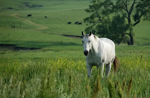
Route 177, Kansas
Distance: 85 miles from Cassoday to Manhattan
Dispel the myth that the plains are plain and boring along this stretch of road through what remains of the tallgrass prairie. Start at Cassoday, just off I-35, then explore several small towns in a sea of golden-green grass.
Cottonwood Falls' Grand Central Hotel and the shops along Broadway make good starting points for refreshments before heading into the Tallgrass Prairie National Preserve just north of town. Once there, take a bus ride out into the park and learn how 170 million acres of tallgrass once stretched from Canada to Texas. When the metal plow was introduced to the region, farming practices broke up the deep roots of big bluestem, Indian, and buffalo grasses. Today, less than four percent of this tallgrass remains, most of it in this park. Bison graze and meadowlarks flit between the draws, where water bubbles up and shrubs and brushes grow. By September, these knee-high grasses will tower above your chest, tall enough that only a buck's antlers move above them.
Next, explore Council Grove, where you can still see the deep ruts dug into the earth by Conestoga wagons 100 years ago on their journeys westward. To the north, the college town of Manhattan recently opened the Flint Hills Discovery Center, which interprets the geological and cultural background of the prairie.
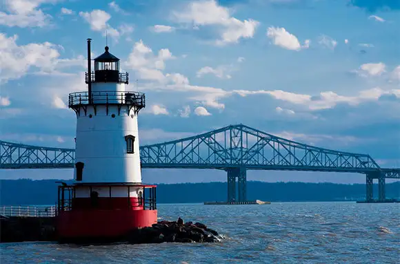
Hudson River Valley, New York
Distance: 57-mile loop from Nyack to West Point to Tarrytown
Not far outside of New York City, the Hudson becomes the three-mile-wide river that has inspired settlers, artists, and architects through America's history. It's where the rest of the state begins. You'll be just as overwhelmed with inspiration along this drive through rural areas, quaint villages, historic parks, and stately mansions.
Start at the Tappan Zee Bridge at I-287 and follow the route up U.S. 9 to West Point. On the way back, cross over to the other side of the river at the Bear Mountain Bridge. In Nyack, a 17th-century Dutch town that was home to artist Edward Hopper, explore artsy cafes and galleries. Further on, you'll clip along the edge of Bear Mountain State Park. Be sure to take a side trip up Perkins Memorial Drive for a camera-worthy view overlooking the Hudson. Then, drive up to see the U.S. Military Academy at West Point; take a bus tour for the best overview.
Along the river's east side, don't skip the Sleepy Hollow Cemetery, where Washington Irving is buried, and the nearby 17th-century Old Dutch Church, where the Headless Horseman continues to haunt. Several Tarrytown-area mansion tours may entice you to peek in on the lives of America's super wealthy, including tours of the Rockefeller's Kykuit and Jay Gould's Lyndhurst.
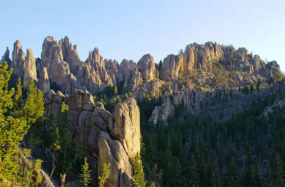
Needles Highway and Iron Mountain Road, South Dakota
Distance: 40 miles from the Crazy Horse Memorial to Mount Rushmore National Memorial
As stunning as Mount Rushmore can be, it's not the biggest rock carving in the southwestern corner of South Dakota. In 1948, Rushmore sculptor Korczak Ziolkowski and Lakota Chief Henry Standing Bear took the first steps toward creating their dream, the Crazy Horse Memorial, a massive carving of the chief on horseback surveying his lands. Every day since, the Ziolkowski family has continued to chip away at the rock. Begin your drive here, where Crazy Horse's face and outstretched arm have taken shape.
Then head deeper into the Black Hills for a 35-mph scenic drive through ponderosa pines, past granite outcroppings and grazing bison, antelope, deer, and elk. Go down 14 miles of the Needles Highway (South Dakota 87) through Custer State Park, home to the largest herd of bison outside Yellowstone. Finger-like granite spires rise from the forest floor, giving Needles its name. The most popular feature of the park, the cathedral spires, sits in the shadow of Harney Peak, the highest point between the Rockies and the Swiss Alps at 7,242 feet.
Turn onto the winding Iron Mountain Road (U.S. 16A) for 17 miles of vista-happy driving. The scenic roadway is known for wooden spiral-shaped "pigtail" bridges and one-lane tunnels that frame Mount Rushmore.
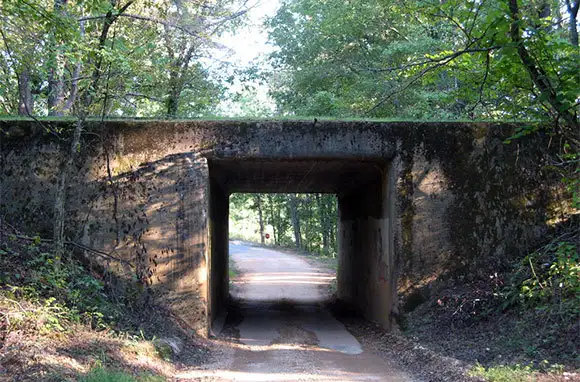
Natchez Trace Parkway, Mississippi, Alabama, and Tennessee
Distance: 444 miles from Natchez, Mississippi, to Nashville, Tennessee
This meandering two-lane parkway cuts an asphalt swath from Mississippi into the rolling farmlands of Tennessee. Ideal for a weekend jaunt, the route follows an ancient path pounded deep into the earth first by an enormous herd of bison moving between feeding grounds and then by Native Americans and the first European settlers. The road teaches as much about American history as the ecology of the region.
The Trace begins in Natchez, the oldest city on the Mississippi River. Set on high bluffs above the river, the town's antebellum mansions sit in the shade of oaks dripping in Spanish moss. Follow the Trace northeast across the historic village of Port Gibson through Jackson and to the Mississippi Crafts Center, home of the Craftsmen's Guild of Mississippi. This is a good area of the route to bicycle or ride on horseback. Midway, stop at the visitors' center at milepost 266 in Tupelo, Elvis Presley's boyhood town.
Clipping the northwestern corner of Alabama, the route moves into Tennessee, where you can hike down the original sunken trace. Further north, exhibits explore the Trail of Tears, the government-forced movement of Native Americans to new lands. Explore the early settlements where Meriwether Lewis, the governor of the Upper Louisiana Territory, lived and died.
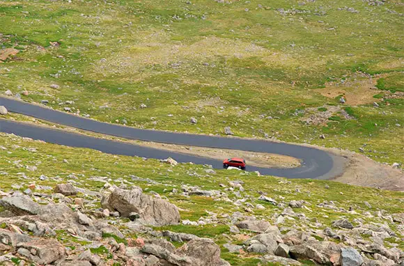
Mount Evans Scenic Byway, Colorado
Distance: 28 miles from Idaho Springs to Mount Evans
This day trip out of Denver climbs the highest paved road in North America. It shoots up from 8,700 feet on I-70 to 14,130 feet at the top. Like Pike's Peak Highway, its cousin to the south, this road was built to bring in tourists.
Winding like a hiking trail around the mountain for 14 miles, the narrow road passes through different ecosystems before emerging above the timberline—and the clouds—on Highway 103. You'll spy bighorn sheep and mountain goats as well as marmots and golden squirrels hanging out by the road. At the top, a quarter-mile trail leads to the summit at 14,264 feet—an easy way to bag a fourteener without all the effort.
More From Smartertravel:
We hand-pick everything we recommend and select items through testing and reviews. Some products are sent to us free of charge with no incentive to offer a favorable review. We offer our unbiased opinions and do not accept compensation to review products. All items are in stock and prices are accurate at the time of publication. If you buy something through our links, we may earn a commission.
Related
Top Fares From Columbus, OH
Today's Top Travel Deals
Brought to you by ShermansTravel
Shop and Save with Country Inns...
Patricia Magaña
 Hotel & Lodging Deals
$229 -- Chicago: Discounted Rates and...
Francesca Miele
 Hotel & Lodging Deals
$229+
$188 -- Honolulu: Save on Oceanview...
Abigail Lamay
 Hotel & Lodging Deals
$188+


